Days 13 and 14 A tale of two trails

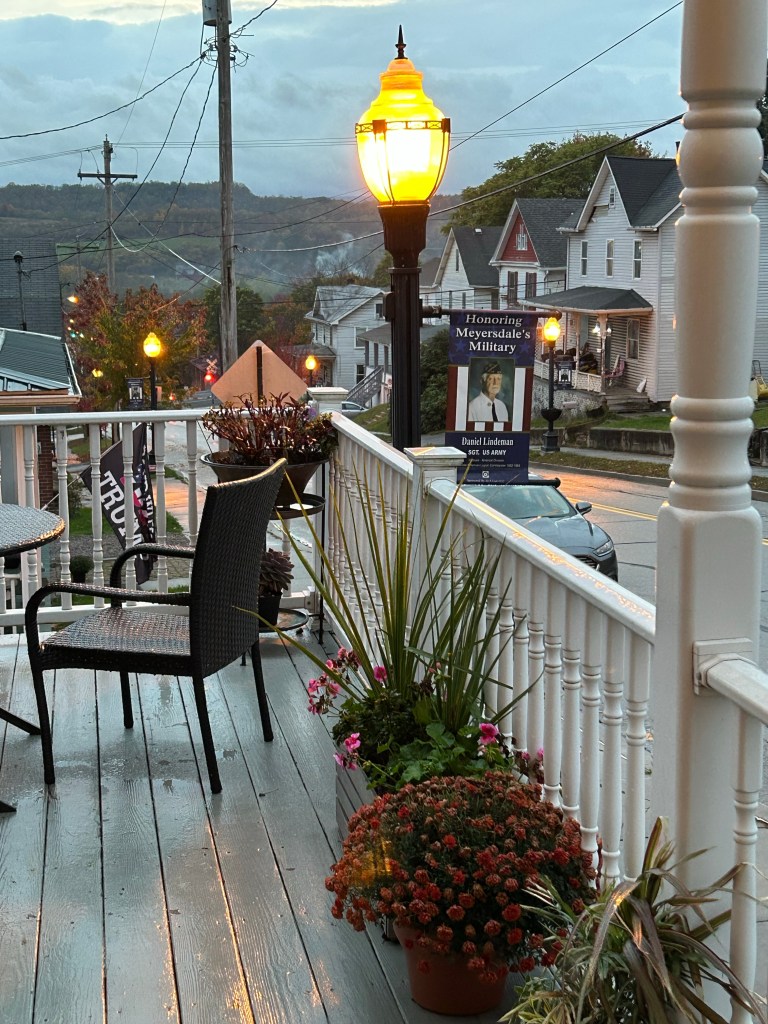
Day 13 Start: Meyersdale, PA GAP mile marker 31, 9 am

End: Stick Pile NPS campground, C& O Canal Towpath, mile marker 149, MD, 5:30 pm

Total miles: 67

Day 14 Start: Mike marker 149, 9 am

End: Hagerstown, MD, 4:15 pm

Total miles: 63

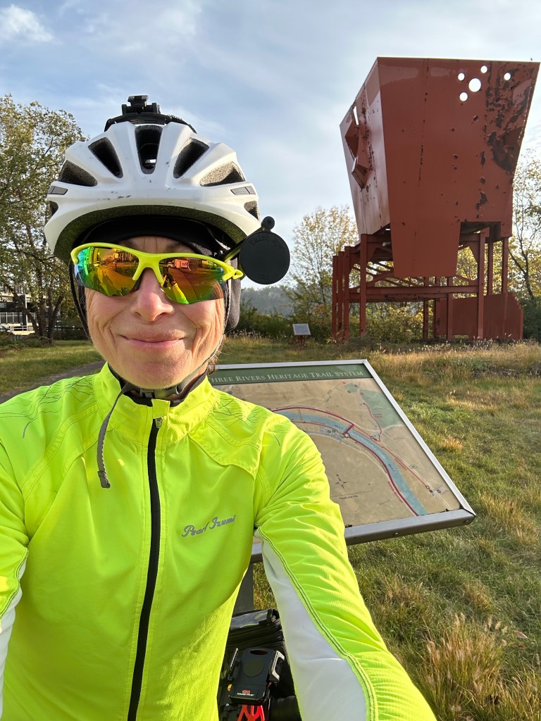
Day 13: The first part of the day was all about the high point of the GAP and the amazing descent. First—the Eastern Continental Divide!

Approaching the divide from the west

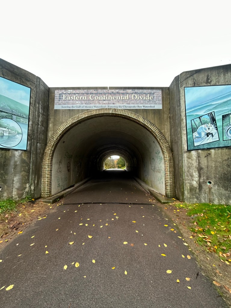
This is the high point of that GAP and along the ridge that marks the divide between the Gulf of Mexico and Chesapeake Bay watersheds. Cool, right?

Dividing line

From that point on, it was all downhill, literally, for >20 miles to Cumberland. What a ride!

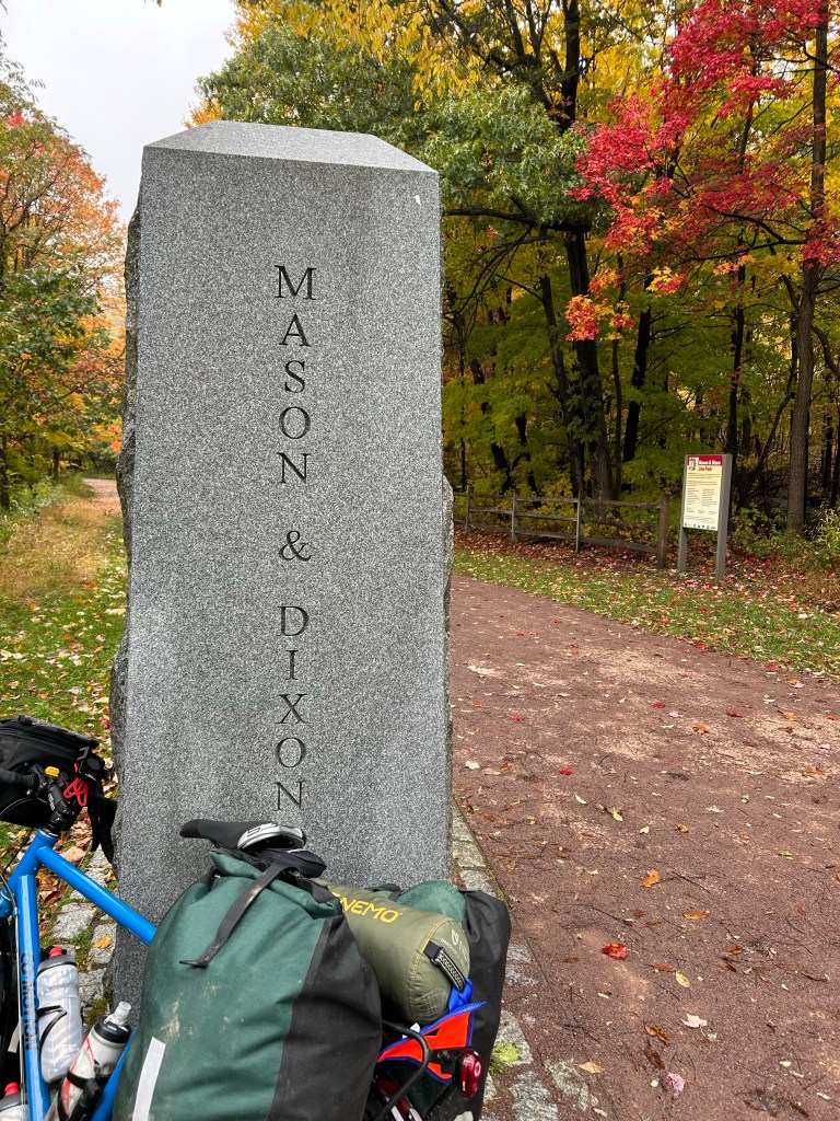
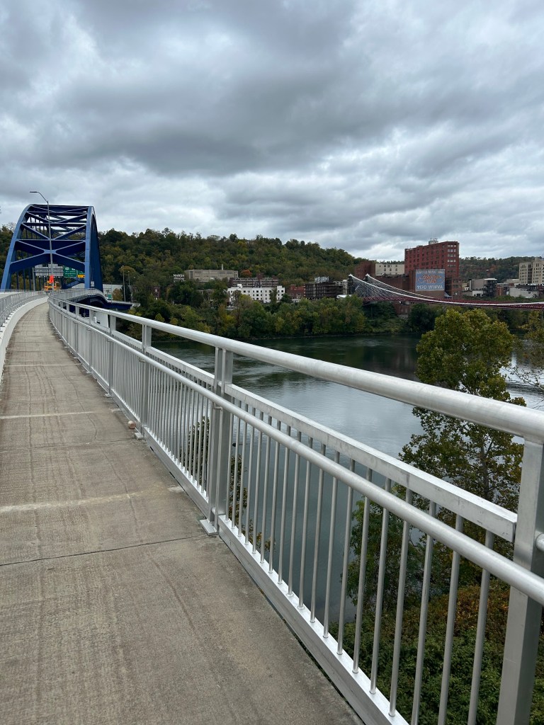
Cumberland is the official terminus of the GAP to the west and the C&O canal towpath going east. My route had me on the C&O for 85 miles. Since I’d just done 150 miles of the GAP in one long day and two short days. I was thinking I could do the C&O portion in about a day and a half.

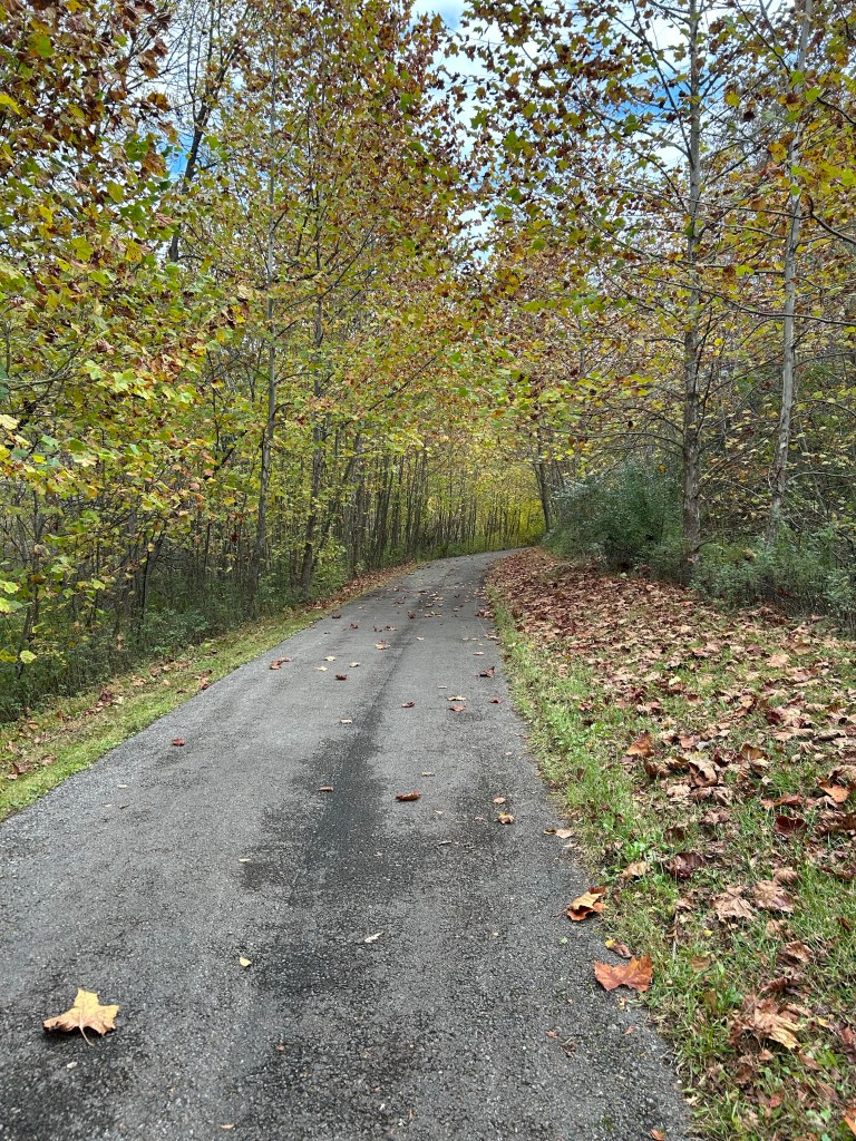
This is where my failure to truly prepare came back to bite. Again. The C&O is to the GAP as the Oregon trail is to I-90. It is basically a dirt hiking path worn by people using it, not machines. Which is lovely. And really hard to ride. And it had just rained for 36 hours.

This is hard to ride on with 40 lbs of gear on a heavy bike

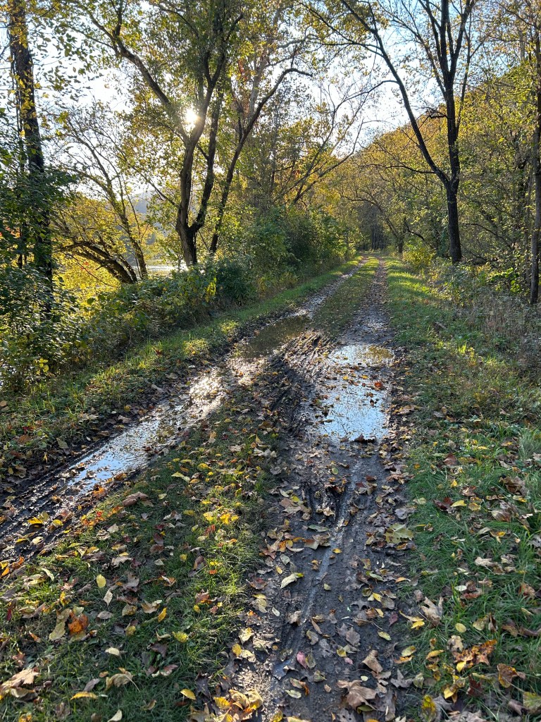
In the first mile I probably went around 10 giant mud slicks like this. And I had 84.5 miles to cover.

There was some despair.

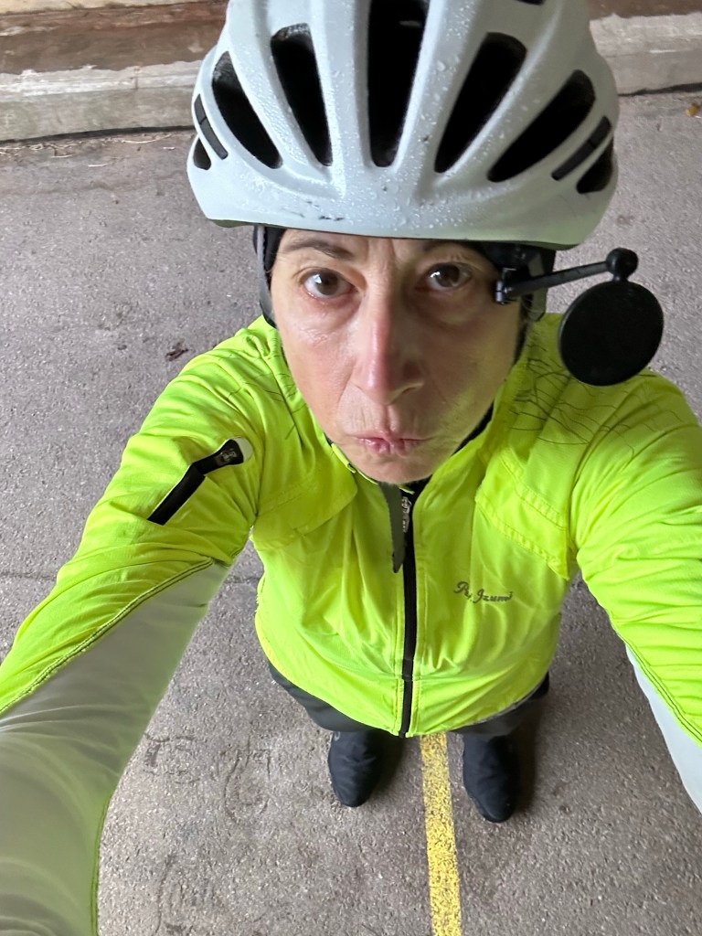
But then I remembered that my bike is a gravel bike, dammit. It was made for this. Even if I didn’t think I could do it, I knew my bike could. So my mantra became “Trust the bike, keep pedaling”. After about 10 miles, I actually started to have fun. People love gravel biking! I can too! Comfort zones be damned!!

There are free hiker/biker campsites every 5 miles on the trail. I waited until going any farther might have meant pedaling in the dark and settled in for the night. Sadly, there was no cell coverage.

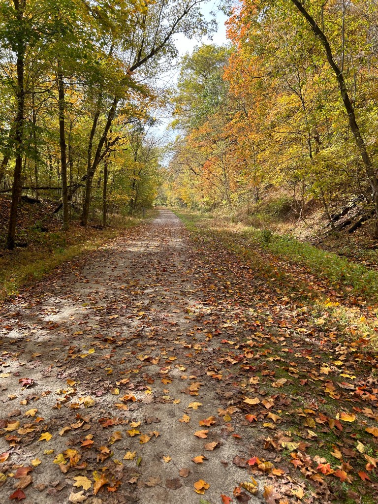
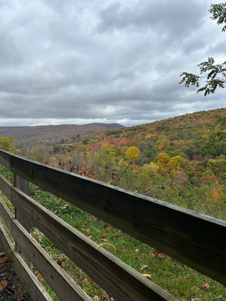
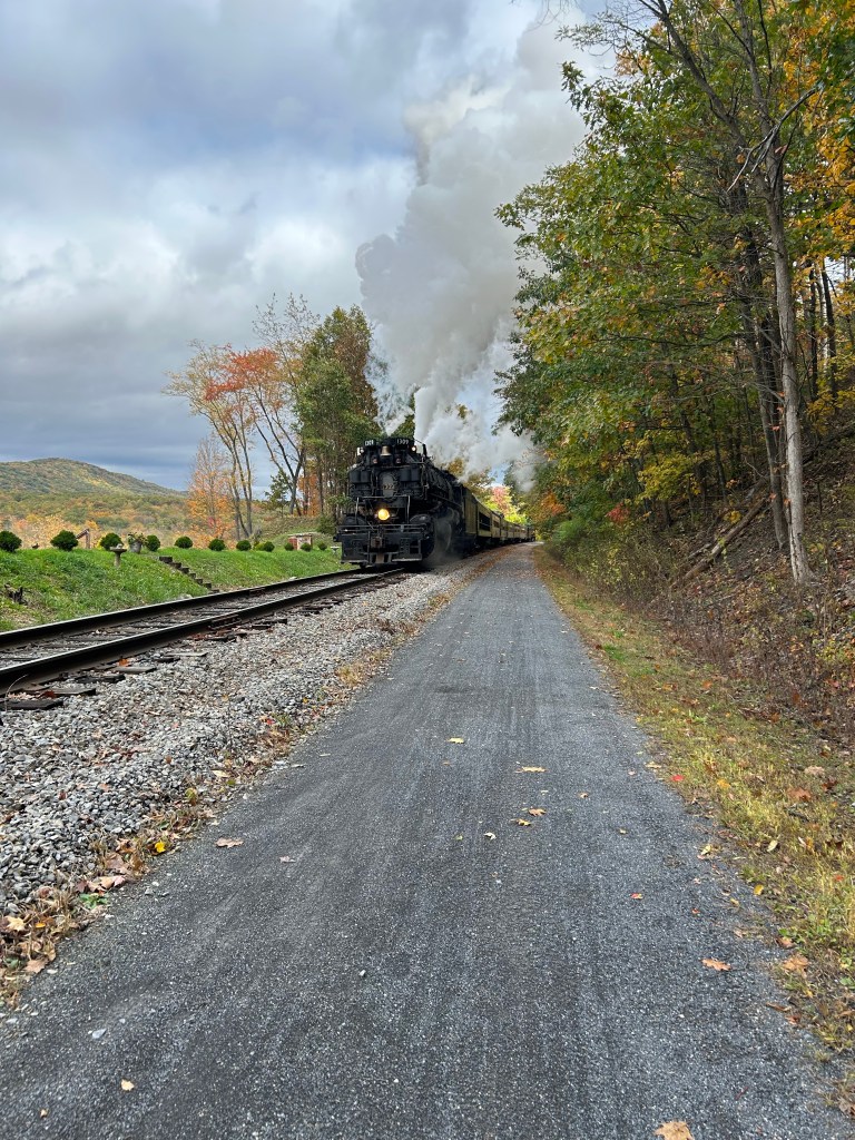
Day 14 started out at mile marker 149–only 49 miles of rugged trail to go until the route left the path. That’s a lot of muddy riding. Again, had I prepared, I would have remembered that there was a 20 mile reprieve on a paved rails to trail route in the middle of all those trail mud flats. And some parts of the C&O were absolute gems.

It wasn’t all doom and gloom
The towpath hugs the Potomac River
One of many canal houses in this amazing national park

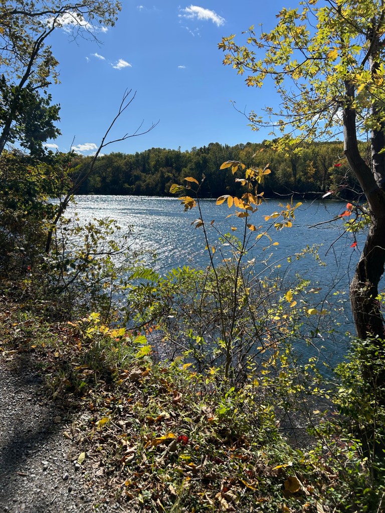
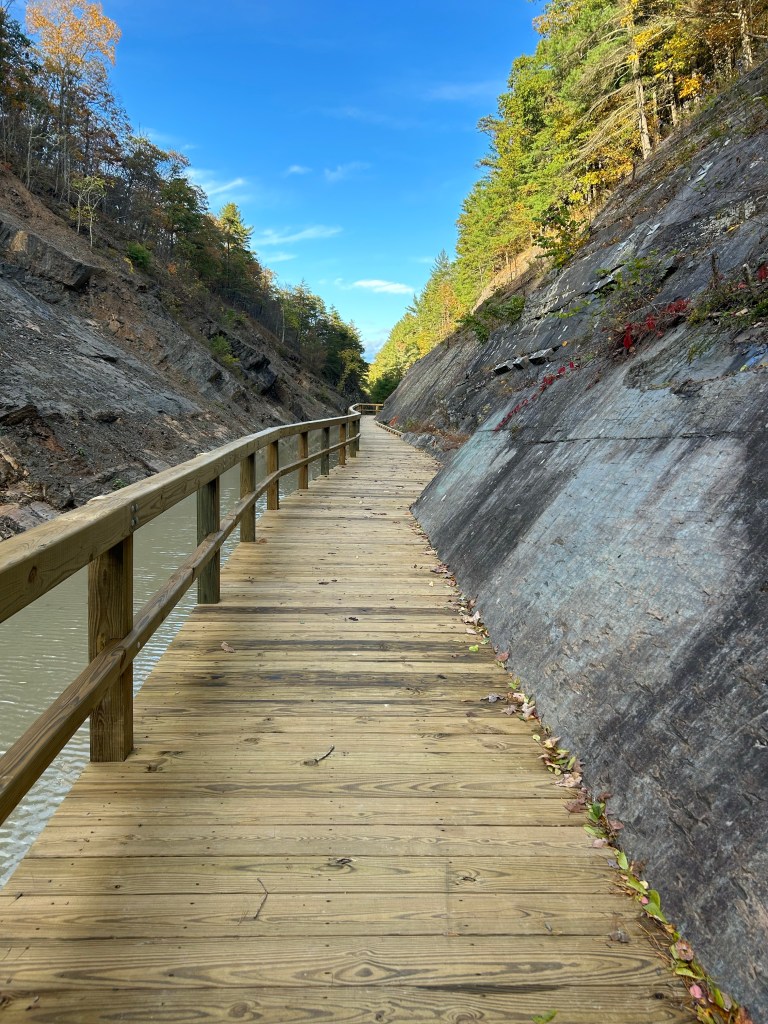
There’s actually a ton of amazing history here, but I’m not on that trip, I’m afraid. I’m pounding miles and riding my ass off. No idea why, but it’s what I’m doing.

Day 12 Soggy trails and cozy digs

Start:Ohiopyle Stste Park, PA GAP mile marker 72, 12 pm

End: Meyersdale, PA GAP mile 31, 4:45 pm

Elevation change: +1.000 fit

Total miles: 41

Weather forecasting really has come a long way. It started pouring exactly as predicted at about 3 am. It was cozy and dry in my tent, and my replacement Whisoerlite stove (thanks, REI!) worked like a dream in the pouring rain onceI finally decided to suck it up and get out of my cocoon.

I really thought I could take down the tent and leave the rain fly up, but alas it is genuinely impossible. Stuff is wet, but that’s why Sea to Summit makes dry bags.

I was dreading going back down that insanely steep, rocky, leaf-covered trail in the rain. But it was fine! The Crocs provided excellent traction, and the bike was much easier to guide downhill than to push up. Easy peasy!

Safely down and ready to plunge back into the GAP!

Today was my shortest day of the trip at just 41 miles. Oh, and a net gain of >1,000 ft did you say? Just 15 miles from the Eastern Continental Divide? Slick, wet surface subsiding under all the rain? Quarter-mile long bridges snd tunnels? All this and more! Adventures aplenty!

Happily, FOR ONLY THE SECOND TIME on this trip (the first being the delightful arrival at the Sabgir’s a week ago), today’s home stretch was drama-free. My adorable B&B was literally across the street from the trail, I had a hot bath and someone to pick me up to shuttle me to a cozy family/run restaurant (it was the owner who picked me up! He dropped me off, went in the side door, showed me to my table and brought me butter) while the B&B owners did my laundry within 90 minutes of getting off my bike. O the joy!

View while waiting for my ride to dinner. Note the train crossing at the bottom of the hill.

I could get used to this.

Happy diners enjoying fresh bread, hot soup and fish fry specials
There is apple butter for the bread! Getting close to Pennsylvania Dutch Country!

Excited for what’s next!

Day 11 Mind the GAP!

Start: Hot Metal Bridge, Mike Marker 145, GAP 9 am

Finish: Ohiopyle State Park, Mike Market 71, GAP 5:40 pm

Total miles: 74

The GAP, I.e. the Great Allegheny Passage, is well-known among touring cyclists. (BTW, I am not a touring cyclist, but I’ve been getting to know some and have been reading their blogs)

Getting ready to jump on the GAP at Hot Metal Bridge in Pittsburgh, mile marker 145

It’s a 150 mile rails to trail path that begins in Pittsburgh and goes to Cumberland, MD (my home state!) and connects with the C&O towpath to go to Washington, DC. It’s incredibly well-maintained with numerous services and primitive campsites every few miles. It’s like Disneyland after the last few days of rugged Appalachian roads.

The path hugs the south bank of the Yougigheny river
This was my view for 70 miles

My %!?#& app told me my campsite was 67 miles from my start, but, as we know, it lies like a rug. It was 74 miles. I figured this out after 45 miles. So once again, I had to really dig in to a big effort day with frantic finish to set up camp before sundown.

The trail heads very gradually uphill to the eastern continental divide at Cumberland. It’s not terribly obvious that you’re climbing except that you are always peddling. All in all, it was a wonderful, beautiful ride.

When I reserved the campsite, the very helpful Pennsylvania State Parks person told me that the connector trail from the GAP to the campground was steep. She was understating the case. I had to take everything off the bike after about 1/4 mile because I couldn’t push the loaded bike up the grade without falling down the hill. But I made it. I may have been yelling to the heavens that it was too hard. It’s possible that there were tears. But I got to my campsite in this really beautiful park and am all tucked in. It’s supposed to start raining at 4 am and rain all day tomorrow.

Day 10 A pleasant surprise

Start:Wheeling, WV 8 am

End: Pittsburgh, PA 4 pm

Total miles:70

Elevation change: +4,478 -4,557

Good as I felt about yesterday, I was really worried about today. Same elevation change, 10 more miles and no place to spend the night if I couldn’t make it. I’d been staring at the nap with dread for days.

I needn’t have worried.

Most if it was on rails to trails! The first part was going north along the Ohio River to the town of Follansbee. I knew that coming out of Follansbee would be the single greatest climb of the trip . And it was. I couldn’t have done it on my road bike without panniers. There was no hope today. I could barely push my bike up. It looks vertical on the profile.

Then after that, it was a magical descent on a quiet tree-lined curvy road, through a gorgeous valley, old towns and farms to.. another rails to trail! If only I’d read the directions instead of looking at the bumps on the map!

There were some long slow climbs coming into Pittsburgh—2 miles’ worth—but the day was more like Indiana plus a hellacious climb than the eastern Ohio hill country of the past 3 days.

Tomorrow—GAP!

Weird to be in a big city again after the eerie isolation of the last three days.

Day 9 Wheeling!!

Start: Seneca Lake Park, OH 9 am

End: Wheeling, WV 4:30 pm

Total miles: 56

Total feet of elevation: 4854 up, 5048 down

Wheeling! What a perfect name for cycling destination! And it does seem that a lot of cyclists come through here.

Today was a little bit of everything. Started out at the bottom of a huge climb to get back on the road from beautiful Seneca Lake. There were tons of deer at my campsite—and it really was mine because there was no one else in the park at any of the hundreds of campsites—and all along the roads near the lake.

The nicely paved roads around the lake soon gave way to the primary surface of the day—gravel! I got to do some gravel biking. Sometimes it was a blast, other times with steep climbs and exuberant dogs, not so much. I got to climb up to several ridges that offered absolutely amazing views.

Appalachia in autumn

After about 30 mikes of mostly gravel roads, the route put me on National Road, aka US 40 for the rest of the way. I went through one historic town after another—Barnesville, St. Clairsville and this abandoned gem, Morrisville.

1802!
Those are very old tombstones!

Then it was down more than 1700 ft all at once into the Ohio River Valley to Wheeling. I’d been forewarned about that descent. It would have been a blast on a road bike, but I pretty much rode my disk brakes the whole way. Sadly the famous Wheeling suspension bridge is under construction, so I didn’t get to ride into town that way. I did get to do the next best thing though, which is to snap a photo.

Getting some luxe accommodations including laundry at the Hampton Inn. Ready for another day like this one, at least according to the maps, tomorrow.

I gotta say, challenging though these rides are, I am so lucky to be able to do this trip. I’m loving >95% of the minutes. (Those semis on highways are seriously scary).

Day 8 Not gonna lie

Start: Dillon State Park CAMPGROUND, OH 10 am

End: Seneca Lake Park, OH 4 pm

Total miles: 52

Today was rough. I started on terrifyingly busy roads with large trucks and a 2 ft shoulder and long steep hills. Then I was on smaller, rougher roads with steeper hills. It was also pretty dreary, with on and off drizzle.

And I had to walk up some of those hills. There weee some that were just too steep for my nerves. No problem turning the gears. I just couldn’t shake the feeling that the front wheel was going to lose contact. It is actually harder to push the bike up those hills. I’m pretty sure that some are steeper than 10% grade. They all had warnings on the maps.

So I guess I broke another personal barrier.

Which is good because I have 30% more climbing to get over tomorrow :/

At least it’s incredibly beautiful. I got to spend some time up on ridges with incredible views of autumn leaves turning on the hills all around. Even though it’s still Ohio for a few more miles, I could t stop singing

Country roads, Take me home…

And I finally got to put up my hammock!

Day 7 A funny thing happened…

Start: New Albany, OH 10:30 am

End: Dillion State Park Campground (which is 12 fucking miles from Dillon State Park—see below)

Total miles: 57

Total useful miles: 49

The day started out beautifully. I spent a restful day off (Day 6) with 3/4 of the beautiful Sabgir family (the other 1/4 was with Seth!) and woke early with David and Kristen to go watch their amazing son Charlie run the Columbus half marathon. What a blast!

Proud parents David. and Kristin Sabgir at mile 3 waiting for Charlie

We got to see Charlie 3 times—at mile 3, 7 and the thrilling finish! He’s an incredible runner—I wish I could say we’re blood relatives because I’d love to say I share some of those genes! He crushed it and came in 21st overall!! OMG!!!

Charlie is on the left about to demolish the guy in front for the finish!!
Amazing and beautiful Sabgir family

After we got the triumphant athlete home, David rode out of town with me to show me the way and help me get off to a great start. We had a lovely ride through bucolic suburban-industrial-rural lands, and he left me on yet another amazing bike trail heading east to Zanesville and the dreaded eastern Ohio hills.

Thanks to a great recommendation from David, I finally took a meal break at an adorable little caboose-turned-cafe called The Station in Granville. I am embarrassed to say how many items I ordered. They were all fabulous.

So many pastries to choose from. No one could eat just one. Right? Right?

The route warned me that there were steep hills and that I might need to get off snd walk. It actually says this on the map. .

May require walking!!!

I’ve been dreading these hills. I have a largely irrational fear of the front of my bike losing contact with he road snd me falling on my head. I am told that, yes, this is possible. This fear is followed by a fear that I won’t be able to clip out of my cleats on a steep hill and will knock my heel into my rear wheel and fall over. That’s because this has happened to me.

So I was pretty wired for this ride.

The scary hills came 5 miles before the end of the ride. There were 2 in a row. I thought front-wheel-down thoughts and made it. I got to the park which had a firing range with lots of gunfire and a “Let’s go Brandon” sticker on the door.

Of the state park office.

I went in to find out where the campsite was, hoping that it wasn’t where the gunfire and conceal and carry classes were., And good news! It wasn’t! It was 12 miles away back over the 2 (bike) flipping hills. Funny, right?

I’m snug in my tent now. having made a hot meal and a passable campfire with wet wood and kindling.

It’s good to be able to put these things in perspective. I feel really lucky today—wonderful family, cared for, safe and healthy. ❤️

Day 5 Friday the 13th!

Starting point: Downtown Dayton, Ohio, 7:55 am

Ending Point: New Albany , Ohio. 6 pm

Total mileage: 90 miles

I have a bad personal history with Friday the 13th. I was pretty nervous about today, partly because I’m superstitious as hell and partly because I’m kind of tired.

I got on the bike just as the sun was coming up having laid waste to the Fairfield Inn breakfast buffet like never before. I actually packed two sandwiches for the road and ate 2 waffles. And then stopped for a large pretzel and Oreos decorated for Halloween and windfall apples on the trail, I have never eaten so much in my life.

Today’s ride was 70-ish miles of rails to trail, most of it into the wind followed by a 20 mile tour through the heart of Columbus. Dayton and Columbus are really well connected with an amazing trail system. The terrain was mostly flat with some on road segments with some ups and downs. Those on road were actually s nice break. It’s hard to bike flat trails for ten hours a day. My arms are actually bearing the brunt of the exhaustion. But I didn’t have any mishaps, close calls, bad encounters or anything, so maybe I can relax about Friday the 13th?

I’m taking tomorrow off to visit with family in Columbus and watch my cousin run the Columbus half marathon Sunday before heading out to tackle the dreaded eastern Ohio hill country.

My body needs a minute.

Day 4 Ohio!

Start: Prairie Creek Reservoir, Muncie, Indiana 9:20 am

End: Dayton, Ohio 5:45 pm

Total miles: 80

Lots of tailwind and rails to trails, i.e., a perfect day on the bike. Blue skies, upper 70s, nice trails and roads, great cheese sandwich for lunch. All good things!

Taking a break on the side of the road in Ohio

Day 3 Life Is for Learning

Start: Wabash, Indiana 9:50 am

End: Prairie Creek Reservoir Park outside of Muncie, Indiana 7 pm

Total miles: 70 miles

The day started out great. I headed out from my Warm Showers campsite to a quick breakfast in town and then onto back corn roads that all looked like this with names like W 350 N

Then onto more rails and trails that looked like this

And had a perfect lunch in Marion, Indiana and great conversation with the owner of the small cafe.

She told me that the trail went all the way to Richmond. So I settled in for a relaxing afternoon in the trail.

But then Apple Maps took me away from the trail (to be fair, it ended though I now know it picked up a bit later) and onto a never-ending zigzag of corn roads—W 150 N then E 850 W, etc left and right, some with gravel, all with startled dogs and all the southbound roads facing into what was easily a 20 mph headwind.

I was grouchy.

I now know that i can’t blindly trust these bots. They are not cyclists.

Eventually I got back on the trail and made it to my campground in time to see the sun set over the reservoir and just before some rain.

Am snug in the tent and looking forward to being smarter tomorrow.

Hope springs eternal.